Long term groundwater storage in Ganga basin declining at 2.6 cm per year Study (GS Paper 3, Environment)
Why in news?
- Groundwater storage levels have been declining by 2.6 centimetres per year in the Ganga basin, according to new estimates.
Details:
- The impacts were more pronounced in Rajasthan, Haryana and Delhi, with average storage declines of roughly 14 cm year−1, 7.5 cm year−1 and 7.2 cm year−1, respectively.
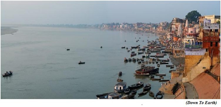
- The average storage decline in Uttar Pradesh, Bihar and West Bengal was estimated to be roughly 2cm year−1, 1 cm year−1 and 0.6 cm year−1, respectively.
Three methods:
- The Ganga Basin’s aquifers are one of the largest reservoirs of groundwater in the world.
- The researchers from CSIRO Land and Water, University of Bergen, and Indian Institute of Technology, Roorkee, used three different methods to study long-term groundwater storage across six states.
First method:
- First, they collected groundwater level data between 1996 and 2017 from the Central Groundwater Board.
- The average groundwater levels have been declining at a rate of 2.6 cm year−1 between 1996-2017.
- West and southwest areas, including agriculturally intensive regions and urban areas like Delhi and Agra, took the biggest hit.
Second method:
- The second method involved the analysis of satellite data from the Gravity Recovery and Climate Experiment (GRACE), which yielded an average loss of 1.7 cm year−1.
- Grace satellites, launched in 2002, assess Earth’s water reservoirs over land, ice and ocean.
Third method:
- For the last method, they turned to a model to study groundwater dynamics and storage changes. The team calculated the volume of water entering and leaving the aquifer storage.
- The difference between the two represented storage loss, which stood at roughly 3.2 cm year−1.
Key observations:
- Delhi and Haryana have high groundwater abstraction rates, which explains the steep decline.
- Rajasthan, whose groundwater reserves contribute about 90 per cent of the drinking water and 60 per cent of the irrigation, is showing an improvement in groundwater levels in the recent past.
- A recent Central Groundwater Board yearbook, which monitors groundwater levels four times a year, found that the water levels in 2021-2022 rose compared to the 2011-2020 average, barring the pre-monsoon period.
Brahmaputra basin:
- The Brahmaputra basin, which was not a part of the study, shows more groundwater level reduction than the Ganga and Indus basins.
- A 2019 study estimated groundwater depletion of greater than 5 cubic kilometres per year in Assam, which falls under the Brahmaputra basin.
Way Forward:
- They now hopes to extend their study to identify districts in the Ganga basin with the highest rates of storage losses.
- They also plan to perform scenario analysis of impacts from climate and other stresses for basin planning and policy decisions for management.
Sonam Wangchuk’s climate fast, Ladakh’s fragile ecology and the Sixth Schedule
(GS Paper 3, Environment)
Why in news?
- Recently, Ladakhi innovator and engineer Sonam Wangchuk completed his five-day “climate fast”, in an effort to draw the attention of Indian leaders to the region’s fragile ecology and to secure its protection under the Sixth Schedule of the Constitution.

Background:
- He had initially planned to fast atop Khardung La, one of the highest motorable mountain passes in the world. However, he claimed that he was placed under house arrest at the Himalayan Institute of Alternatives (HIAL) by the local administration and denied permission to go ahead.
- He also alleged that he was asked to sign a bond instructing him to not make any public speeches or participate in public assemblies in Leh district.
Who is Sonam Wangchuk?
- He is an education reformist and an engineer, and is known for taking on multiple challenges to improve the lives of the people of Ladakh and to protect the region’s ecosystems.
- He has received various prizes, including the prestigious Ramon Magsaysay award. He is also the founding director of HIAL.
Ladakh’s fragile ecology:
- In a video ‘SOS’ message addressed to Prime Minister, he drew attention to melting glaciers in the Ladakh region and the resulting effects on the region’s ecology. He said that Ladakh and the Himalayas form the ‘third pole’ of the world and are among its few frozen freshwater sources.
- The Himalayas, along with all glaciers and river basins, are also called the “water tower of Asia”. Glaciers in Ladakh have been melting at an alarming rate.
- According to a study published in 2021, glaciers in the Pangong region retreated around 6.7% between 1990 and 2019.
Importance of Glaciers in Ladakh:
- Ladakh is a cold desert and extremely sensitive to climate change. People of the region depend on glaciers to fulfil their water needs.
- The melting of glaciers has three effects on the lives of Ladakh’s people: they lose potable water; agriculture practices specific to the region are threatened; and sustainable practices that support life in the region, like surviving on a minimal quantity of water, are slowly eroded.
- Loss of sustainable practices due to scarcity of water may also affect the livelihoods of locals and their cultural heritage, and force them to migrate.
- A change in the ecological balance of Ladakh will also impact the biodiversity of the area. The flora and fauna of Ladakh are highly evolved to survive in harsh climatic conditions and will be threatened due to changes in the local ecosystems.
- Even the slightest disturbances in an ecosystem as fragile as Ladakh can lead to the collapse of the whole ecosystem.
Increased precipitation:
- It is possible climate change will lead to excessive rainfall in Ladakh by around 2045 due to global warming.
- An increase in temperature has a direct impact on precipitation in an area, which changes agriculture practices. This eventually affects food security.
- Unabated development in sensitive areas like Ladakh, without keeping in mind the sustainable practices that have supported life under extreme conditions, will eventually lead to disruption of the area’s ecology.
What is the Sixth Schedule of the Constitution?
- The Sixth Schedule of India’s Constitution protects tribal populations and provides autonomy to communities to frame laws on land, public health, agriculture, etc.
- Currently, ten Autonomous Development Councils exist in the tribal areas of Assam, Meghalaya, Tripura, and Mizoram.
- Ladakh was previously protected under Article 370, but the Indian government’s revocation of Jammu and Kashmir’s special status removed the provisions for Ladakh as well. Ladakh became a Union Territory.
Parliamentary Standing Committee:
- In response to a report tabled by the Parliamentary Standing Committee on Home Affairs in Rajya Sabha, the Home Ministry said in December 2022 that the main objective of including tribal population under the Fifth/Sixth Schedule is to “ensure their overall socio-economic development, which the UT Administration has already been taking care of since its creation. Sufficient funds are being provided to Ladakh to meet its overall developmental requirements”.
- The standing committee recommended including of Ladakh in the Sixth Schedule because its tribal communities account for 79.61% of its total population.
Scientists use outer space particles to examine the fortress wall of Xi’an city
(GS Paper 3, Science and Tech)
Why in news?
- As per a new study, researchers are examining the fortress wall of Xi’an, an ancient city in China, by using tiny outer space particles that can penetrate hundreds of metres of stone surfaces.
- Known as muons, these particles have helped them find small density anomalies, which are potential safety hazards, inside the wall.
- Xi’an’s wall is 12 metres high and 18 metres thick. To analyse this 14 kilometres long rampart, researchers deployed a technique called muon tomography or muography, which uses muons to generate three-dimensional images of such large structures.

What are muons?
- Muons are subatomic particles raining from space. They are created when the particles in Earth’s atmosphere collide with cosmic rays, clusters of high-energy particles that move through space at just below the speed of light.
- These particles resemble electrons but are 207 times as massive. Therefore, they are sometimes called “fat electrons”.
- Because muons are so heavy, they can travel through hundreds of metres of rock or other matter before getting absorbed or decaying into electrons and neutrinos. In comparison, electrons can penetrate through only a few centimetres. Muons are highly unstable and exist for just 2.2 microseconds.
What is muon tomography or muography?
- Muography is conceptually similar to X-ray but capable of scanning much larger and wider structures, owing to the penetration power of muons.
- As these high-energy particles are naturally produced and ubiquitous, all one needs to do is place a muon detector underneath, within or near the object of interest.
- The detector then tracks the number of muons going through the object from different directions, to form a three-dimensional image.
Muons and archaeology:
- The technique was first used in the late 1960s, when Nobel Laureate and US experimental physicist Luis Alvarez joined hands with Egyptologists to search for hidden chambers in the Pyramid of Khafre, Giza. Nothing was found at the time.
- However, in 2017, modern archaeologists repeated the experiment with more sophisticated and advanced muon detectors and stumbled upon a major finding.
- By placing several detectors in the queen’s chamber and in an adjacent corridor within the pyramid and at its base on the north side, the archaeologists were able to discover a previously unknown chamber at least 30 metres long. It was the first major inner structure to be found in the pyramid since the 19th century.
- Much like the 2017 experiment, scientists of the latest study also used a muon detector, called CORMIS (Cosmic Ray Muon Imaging System), to examine the wall of Xi’an city.
Applications of muography:
Way Forward:
- According to a 2022 study, with the help of this technique, researchers are trying to understand the finer details of the volcano’s internal structure. They hope that the data will play a crucial role in predicting what hazards to expect in an eventual eruption.