How govt drone survey is clearing up land ownership in villages across India (GS Paper 3, Economy)
Why in news?
- The State governments have issued as many as 1.32 crore property cards in 2.55 lakh villages across the country as of June 2023, giving people ownership documents for their property under SVAMITVA Yojana.
SVAMITVA Yojana:
- The central government’s Survey of Villages and Mapping with Improvised Technology in Village Areas (SVAMITVA) Yojana, which creates a Record-of-Rights (RoR) for inhabited areas (as opposed to agricultural land) in villages.
- The scheme was launched in April 2021 after a pilot project was carried out in nine states: Haryana, Karnataka, Madhya Pradesh, Maharashtra, Uttar Pradesh, Uttarakhand, Punjab, Rajasthan, and Andhra Pradesh.
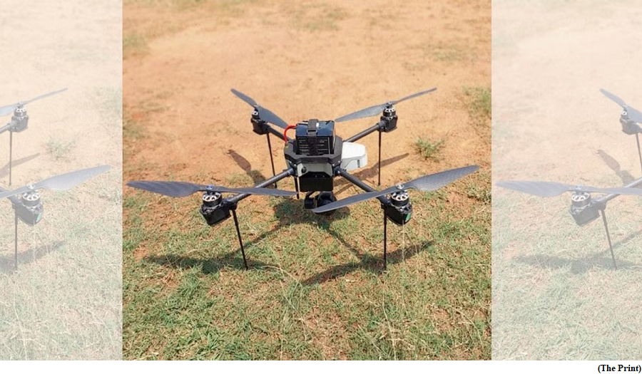
- The Survey of India is preparing maps using drones and information provided by state governments about property owners after on-field verification.
- The SVAMITVA scheme is also meant to address land-related disputes, help villagers take bank loans against their properties and aid gram panchayats in preparing development plans and collecting property tax.
- The yojana is being implemented in 3.72 lakh notified villages out of 6.62 lakh villages in 31 states and Union Territories (UTs).
- West Bengal, Bihar, Meghalaya and Nagaland didn’t participate in the scheme, nor did Chandigarh, which doesn’t have any villages.
Implementation:
- The Ministry of Panchayati Raj, which is implementing the scheme together with state governments, has already mapped 69 percent of the notified villages, and plans to complete the drone surveys by March 2023.
- The drone survey is complete in nine states and UTs and work is on to finalise the maps. These are: Uttarakhand, Madhya Pradesh, Goa, Haryana, Delhi, Puducherry, Lakshadweep, the Andaman and Nicobar Islands, and Dadra & Nagar Haveli and Daman & Diu.
- Uttar Pradesh has issued the highest number of property cards (57.26 lakh in 39,823 villages) followed by Haryana (25.90 lakh in 6,260 villages), and Madhya Pradesh (20.89 lakh in 16,797 villages).
- In several other states including Karnataka, Kerala, Mizoram, Manipur and Tripura less than 25 percent of the villages have been surveyed using drones.
How it helps people, government?
- In the case of agricultural land, state authorities record ownership in the RoR, which provides good evidence and can be relied on by banks while disbursing loans.
- But most states don’t have a record of rights for the abadi (inhabited) area. This missing data has resulted in several land disputes over the years, especially as populations grew.
- The data is also being used by some gram panchayats to collect property tax, resulting in an increase in their income.
- The data is also being used to plan infrastructure development.
Use of drones & new eco-system:
- The Survey of India is using drones and the Continuously Operating Reference Station (CORS) technology to capture images and prepare maps.
- Drones are used to capture images based on details provided by the state government and marking done on the ground.
- The draft map is shared with the state to verify property-wise details on the ground. The map is then updated, and the state governments use its final version to issue property cards.
How ISRO Chandrayaan-3 is it different from Chandrayaan-2
(GS Paper 3, Science and Technology)
Why in news?
- The Indian Space Research Organisation (ISRO) is making the final preparations to launch the third edition of its lunar mission, Chandrayaan-3.

Details:
- Chandrayaan-3 mission aims to land a rover on the Moon. Isro is currently in the process of integrating the Chandrayaan-3 spacecraft with the GSLV-MkIII rocket that will carry it to the Moon.
- The third edition of the lunar mission comes around four years after the partial failure of the Chandrayaan-2 mission, which crash-landed on the surface of the Moon in 2019.
Key Difference:
Payloads:
- While Chandrayaan-2 comprised of Vikram lander, Pragyan rover, and an orbiter, Chandrayaan-3 will launch with just a lander and a rover.
- It will use the Orbiter already hovering above the Moon launched with Chandrayaan-2 for its communications and terrain mapping requirements.
Visible changes:
- ISRO has also introduced some other visible changes in the Chandrayaan-3 mission, after its learnings from the loss of Chandrayaan-2.
- The new mission is being launched with Lander Hazard Detection & Avoidance Cameras that will be used to coordinate with the Orbiter and the mission control as the lander makes its descent approach to the surface of the Moon.
- While Chandryaan-2 had just one such camera, Chandrayaan-3 has been fitted with two such cameras.
In-situ instruments:
- The Chandrayaan-2 Orbiter was launched with an impressive list of nine in-situ instruments that are still operating in the Moon's orbit.
- In comparison, the propulsion module of the Chandrayaan-3 mission will have just a single instrument named Spectro-polarimetry of HAbitable Planet Earth (SHAPE), which will analyse the spectrum of Earth to generate data for habitable planets.
- The data will be used to study exoplanets and create a standard to recognise the habitability of the exoplanets found outside the Solar System.
LRA:
- Another addition to the Chandrayaan-3 mission is the Laser Retroreflector Array (LRA) being sent with the lander, which is a passive experiment to understand the dynamics of the Moon system.
- The other three payloads being launched with the mission are the same as that of the Vikram lander on Chandrayaan-2.
Way Forward:
- ISRO is planning to launch the Chandrayaan-3 moon mission in the middle of July.