Floods in UAE and Oman (GS Paper 3, Environment)
Context
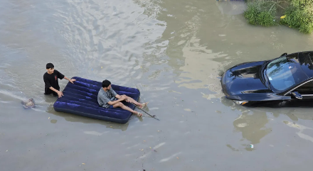
- As per the researchers, the Deadly storms that submerged Dubai and caused fatalities in Oman were likely made worse by climate change.
Heaviest Rainfall
- Over a period of less than 24 hours, the United Arab Emirates experienced its heaviest rainfall since records began 75 years ago.
- Dubai, a glitzy desert city accustomed to months with no precipitation at all — experienced the equivalent of more than a year and a half’s worth of rain in that time.
- Also, the Arabian Peninsula, on which the UAE and Oman sit, occasionally experiences intense bouts of rain in April and May from what’s known as mesoscale convective systems — several thunderstorms that together act as a single weather system.
Reasons for the Extreme Rainfall
Global Warming
- A team of 21 scientists and researchers, under the World Weather Attribution initiative, found that climate change was causing extreme rainfall events in the two countries — which typically fall during El Niño years — between 10 and 40% more intense than they would have been without global warming.
- The atmosphere in a 1.2-degree warmer world can now hold 8.4% more moisture, which is making extreme rain events more intense.
- Changing circulation patterns driven by global warming are also increasing rainfall intensity.
El Nino:
- The rainfall happened after months of hotter-than-average sea surface temperatures partly caused by El Niño – which is when warm waters rise to the surface of parts of the Pacific Ocean.
- The higher ocean temperatures added more moisture to the atmosphere, making heavy rainfall more likely.
- Infrastructure and Soil of the Region: Cities built without adequate storm management combined with very dry soils in the region that struggle to absorb excess water also made the impact worse.
- The UAE and Oman floods have shown that even dry regions can be strongly affected by precipitation events, a threat that is increasing with increasing global warming due to fossil fuel burning.
What are Floods?
- Floods are the most frequent type of natural disaster and occur when an overflow of water submerges land that is usually dry.
Types of Floods
- Flash floods are caused by rapid and excessive rainfall that raises water heights quickly, and rivers, streams, channels or roads may be overtaken.
- River floods are caused when consistent rain or snow melt forces a river to exceed capacity.
- Coastal floods are caused by storm surges associated with tropical cyclones and tsunamis.
- Urban flooding occurs as a result of land development. Permeable soil layers are being replaced by impermeable paved surfaces, through which water cannot infiltrate.
What Causes Floods?
Natural Causes:
- Prolonged rainfall: When rain falls for a prolonged period of time, the soil can become saturated. When water is unable to infiltrate into the saturated soil, it is forced to flow over the soil, thus increasing surface runoff.
- Intense/Heavy rainfall: When rain falls heavily; the raindrops hit the ground with a force. This can cause the rain drops to bounce off the soil instead of infiltrating into the soil. The water from the rain is then forced to flow over the surface instead, thus increasing the surface runoff.
- Relief refers to the difference in height between the highest point and the lowest point on land.
- When rain falls, the surface runoff can move very quickly from mountainous or hilly areas to low lying areas making these low lying areas more prone to flooding.
Anthropogenic Causes
- Deforestation: The lack of vegetation encourages water to flow over the surface rather than infiltrate into the soil thus increasing surface runoff.
- Poor land use practices: Slash and burn agriculture, over-cultivation and overgrazing eventually cause the soil to become infertile and unable to sustain vegetative growth. Consequently, the lack of green cover encourages water to flow over the surface rather than infiltrate into the soil thus increasing surface runoff.
- Urbanization leads to the replacement of permeable soil with that of an impervious layer of pitch and concrete, through which water cannot infiltrate.
- Improper waste disposal: Oftentimes, garbage that is not properly disposed enters into drainage systems and clogs drains.
- Quarrying is the clearing of land for the removal of aggregates (mainly sand and gravel) which is to be utilized in the construction industry. The action of quarrying leaves land bare and devoid of any trees and shrubs hence increasing surface runoff produced.
- Collapsed Dams: If the dams begin to collapse, they will discharge more water downstream, resulting in flooding.
- Climate change: Uncontrolled human activities can contribute to climatic changes, which are responsible for flooding in most regions.
Implications
- Drowning accounts for 75% of deaths in flood disasters. Flood disasters are becoming more frequent and this trend is expected to continue.
- Drowning risks increases in low- and middle-income countries where people live in flood prone areas.
- Floods can also have medium- and long-term health impacts, including:
- water- and vector-borne diseases, such as cholera, typhoid or malaria
- injuries, such as lacerations or punctures from evacuations and disaster cleanup chemical hazards,
- mental health effects associated with emergency situations,
- disrupted health systems, facilities and services, leaving communities without access to health care.
- Damaged basic infrastructure, such as food and water supplies, and safe shelter.
- Economic losses to the State and individuals are also major concerns of the flooding.
Prevention
- Drainage Improvement: Ensure that there is proper drainage or expand on existing drainage systems whenever there’s new settlements or structures being constructed.
- Diversion of Flood Water: Diverting all or a part of the discharge into a natural or artificially constructed channel, lying within or in some cases outside the flood plains is a useful means of lowering water levels in the river.
- Catchment Area Treatment/Afforestation: Watershed management measures such as developing the vegetative cover i.e. afforestation and conservation of soil cover serve as an effective measure in reducing flood peaks.
- Anti-erosion Works: Bank erosion can be minimized by adopting measures that aim at deflecting the current away from the river bank or which aim at reducing the current along the bank of the river and induce silt.
- Inspection, Rehabilitation and Maintenance: Structural works require a periodic and systematic inspection, rehabilitation and maintenance programme to ensure that the design capabilities are maintained.